
Walk a Willingboro Street by Address
A street-by-street search in Willingboro starts with a single confirmed address. The useful record trail is address, parcel key, recorded party, then earlier title evidence. The Township-linked tax source and Burlington County mapping tools can supply the first parcel reference. The County Clerk’s land index then uses that reference only for its newer records. Older work shifts to names and archives. This is why a deed party is evidence of a recorded transaction, while a parcel alone does not establish every person at an address.
- Enter the complete location in the Willingboro WIPP taxpayer portal or the County’s map tools, and preserve the block, lot, and qualifier if shown.
- Use the parcel key in the County mapping workflow to check the property boundary and separate nearby parcels from the focal address.
- Run the appropriate Burlington County PRESS search, then save the instrument or book-and-page reference before moving backward.
- Read the grantor, grantee, recording date, and legal description together. A legal description is the deed’s formal parcel wording and is more durable than a street label.
- For historical household clues, take the verified name or earlier locality label to library, archive, census, and newspaper sources rather than treating the parcel record as a resident list.
Note: A street address opens a record trail, but each custodian controls a different part of that trail.
Willingboro Street Directory Search Keys
The County assessment directory points Willingboro users to WIPP. Its published lookup choices are block, lot, qualifier, account number, name, and address. Those are inputs, not a promise that every detail appears on a result screen. The research did not verify a live result card, so owner mailing details, exemptions, sketches, sale history, and linked documents should be checked directly before being relied on. For a street directory search, the block-and-lot route is the most stable handoff to the deed index.
| Willingboro search field | Entry type | How it helps an address search |
|---|---|---|
| Block | Text, used with lot and qualifier | Starts the local parcel reference. |
| Lot | Text, used with block and qualifier | Distinguishes the parcel within a block. |
| Qualifier | Text when applicable | Refines a parcel identifier. |
| Account number | Alternate text route | Useful when it appears on a tax notice. |
| Name or address | Alternate lookup route | Supplies a start that still needs parcel confirmation. |
- Parcel
- A defined piece of land in the assessment system.
- Situs address
- The physical location of that parcel.
- Plat
- A recorded map or plan connected to land records.
- Criss-cross directory
- An address-to-name reference volume, not a complete occupant list.
Map Willingboro Streets Parcel by Parcel
The Burlington County Property Viewer documents address, owner, and Township-Block-Lot modes. Its guide gives the Willingboro composite locator as 0338-Block-Lot[-Qualifier]. When the viewer is available, its address autocomplete, municipal bookmarks, layer controls, feature popups, current-extent attribute filtering, and measurement tools help distinguish one parcel from the next. A visible boundary is still a map aid, not a proof of title or occupancy.
The County’s Interactive Maps notice currently labels the Property Viewer interfaces offline. That makes the fallback important: use WIPP or the State Property Explorer for a parcel entry point, call County GIS at 609-265-5125 for map help, and use a specific address or block/lot in a request. The State source can corroborate assessment geography, but it warns that its January tax-list snapshot may lag later transfers.
Willingboro Street Directory PRESS Eras
PRESS is a key comparison point for a Willingboro street directory because its access changes by recording era. The online system is not a universal address index. Records recorded on or after March 1, 2012 may be searched by block and lot or owner. The 1965 through February 2012 period is owner-name-only. Pre-1965 images sit in the separate County archive and are also owner-name-only with Guest Login. Maps recorded before 1995 are not in PRESS.
| Recorded period | Best documented route | Street-search limit |
|---|---|---|
| On or after March 1, 2012 | PRESS block/lot or owner search | Use the parcel key before searching. |
| 1965 to February 2012 | PRESS owner-name search | Address-only searching is not available for this interval. |
| Before 1965 | County historic image archive, Clerk counter, and archival sources | Owner-name route only; confirm each result. |
This three-way split is the local records quirk. An empty modern search may mean the right record sits in a different era and uses a different key.
Note: Preserve the recording period because it determines whether PRESS accepts a parcel key or only a party name.
Willingboro Street Records by Address
Several records attach to a Willingboro address, but their coverage is not interchangeable. The table below keeps ownership, parcel mapping, recorded documents, municipal application inquiry, and historical references in their proper lanes. It does not turn any one source into a street-wide resident roster. The state voter-status tool is an individual self-service check, and any formal voter-list request is governed by election law, protected-address rules, and a non-solicitation limit.
| Address-linked record | Keeper | Useful result | Access boundary |
|---|---|---|---|
| WIPP tax information | Willingboro / county-linked portal | Address, name, account, or parcel lookup start | Live result fields were not captured. |
| County GIS | Burlington County GIS | Parcel outlines, aerials, and map layers | Viewer availability can change. |
| PRESS recordings | Burlington County Clerk | Recorded party and document reference | Search method changes by era. |
| FastTrack inquiry | Willingboro Building/Zoning | Address-based application inquiry | Public result fields were not verified. |
| Library reference sources | Willingboro Public Library / State Library | Historical household or address lead | Not evidence of every current resident. |
Tax correspondence can differ from the situs address. The Township’s Tax Record Change Request proves that the Assessor maintains a separate mailing field, not that it is displayed publicly or identifies a current occupant.
Follow a Willingboro Street Deed Trail
Once a current parcel and a recorded reference are known, the deed chain is name-and-description research. In the newer PRESS period, search the parcel or owner, then record the grantor, grantee, recording date, instrument number or book/page, and legal description. Search the earlier owner as a grantee to find that person’s acquisition. Repeat only while the legal description or block/lot remains consistent. A matching street address by itself is not enough, especially across older municipal names and boundaries.
The Clerk also keeps an in-office public index and says unavailable records can require hard-copy searching. The Clerk’s document-copy information lists its Mount Holly office, 609-265-5122, and countyclerk@co.burlington.nj.us. Bring a document type plus book/page or instrument number. Clerk staff are not title searchers. That practical limit keeps a request focused on the record rather than an open-ended search for a person.
Willingboro Parks Shape Street Searches
Willingboro’s planned-community layout has twelve named parks or sections, and the Township says streets within a section share its initial letter. That pattern can help a by-street researcher recognize local geography without inventing a citywide grid. It also explains why a search should retain the full address, municipality, and parcel key rather than rely on a street name alone.
Historical labels need the same care. The Township became Levittown in 1959 and returned to Willingboro in 1963 after the 1956 boundary revision. Older rural records may use Wellingborough or another period-appropriate name. No authoritative source identified a street-renumbering or street-renaming event, so do not assume one. Use the deed date, legal description, and historic locality name together.
Note: The same-initial street pattern is a navigation clue, not a parcel or resident identifier.
Use Willingboro Address Files Carefully
Address-keyed municipal files can provide a narrow administrative history. The FastTrack Citizen Services portal says a public inquiry can search Building/Zoning applications by address when a permit number is unknown. It also supports application uploads, payments, and inspection requests. The available research did not capture a live result, so the safe claim is that an address inquiry exists, not that it displays a particular name, inspection date, or value.
The FastTrack address-inquiry screen shows the Township’s public application-entry route.
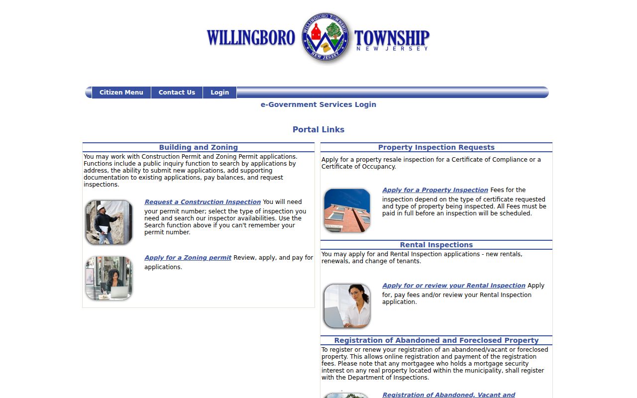
Use an application hit as a lead for a specific department record, then confirm its scope and date with the custodian.
The Inspections and Code Enforcement Form Center shows the Township’s address-related administrative categories.
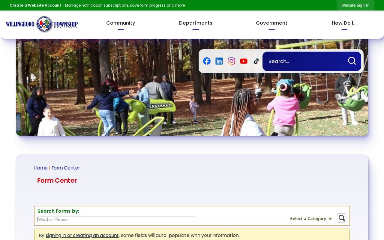
The existence of a form shows that a record type may exist. It does not create a public search index for applicants or cases.
The vacant-property registration form illustrates the specific address fields a narrow request may reference.
The form is not a public directory. For an older address file, ask Inspections or Code Enforcement for the exact record type and date range, then use the Township’s NextRequest OPRA channel if a formal request is needed.
Request Willingboro Street Files Precisely
When an address file is not available through a public inquiry, the Township Clerk directs requesters to the Willingboro NextRequest OPRA portal. A workable request names the department, the actual record sought, the address or block/lot, a definite time period, and the preferred delivery method. The portal supports submission, status tracking, notifications, and access to responsive records or prior requests where available. An email may be reviewed for OPRA compliance and can require the portal form or more detail.
OPRA is a records-access route, not a request for the Township to identify people along a street. The normal response period for a currently available record is seven business days under N.J.S.A. 47:1A-5(i), subject to statutory exceptions and extensions. Ask the department which record label it uses before filing. For example, a construction application, inspection file, code notice, map, or tax record has a different custodian and may carry a different access limit. A narrow request preserves the address trail without turning a municipal file into a resident directory.
Note: Include the property reference and date range so the custodian can locate a record without creating a new compilation.
Willingboro Street History Sources
A current or recent address lead may appear in the Willingboro Public Library catalog’s 2019–20 Burlington County cross reference directory, held as reference only. It is a starting point, not proof of a person’s present connection to the address. For the older rural era, the 1913 Farm Journal Farm Directory of Burlington County uses surnames, rural routes, ownership markers, acreage, and road-map codes rather than modern street addresses.
Willingboro Public Library’s local history room is at 220 Willingboro Parkway. Ask its staff for a specific title or year, such as a Levittown telephone book, reverse directory, yearbook, map key, or municipal ephemera, then preserve the volume information. The online research did not establish a continuous local criss-cross or commercial directory run, so a shelf inquiry is more accurate than assuming one exists.
The historical shelf is fragmentary by design. The 1913 volume predates the planned community, while later local materials can use Levittown or Willingboro. The fuller collection context belongs with the Willingboro city directory collections. For a pre-1965 land trail, compare the County archive, Clerk counter, State Archives deed microfilm, and FamilySearch catalog rather than forcing a rural route into a modern street.
Willingboro Street Directory Privacy Limits
A Willingboro street directory can connect an address to parcel and recorded-document clues. It cannot establish every household member. A deed party, a tax mailing field, a voter status, and a physical property location are different facts kept under different rules. The State voter portal is not a street roster. Motor-vehicle information and nonpublic customer records are not substitutes when the public trail ends. Daniel’s Law and the Address Confidentiality Program can also limit disclosure for protected people.
Lawful use. Use address records for personal, lawful research, family history, and property questions. New Jersey law prohibits stalking and harassment; never use a record trail to watch, threaten, or harm another person.